 |
|
| Seattle, WA July 15, 2000 | Number 10 | ||||
 | Sextant Sights Now Online Seattle, Aug 8, 2000 — In the news item below we discuss sextant sight accuracy and to follow up on this we did some sights during this past Vic-Maui race using both plastic and metal sextants on land and underway. These are now described in detail and posted here to illustrate the points we made in the letter to the editor. Please see Vic-Maui Sextant Sights. It is an illustrated pdf document. Starpath Cel Nav students: please treat these as another set of practice exercises. All data are presented. They can be checked by any means of sight reduction. Let us know if you have any questions. | ||||
| New Celestial Navigation Discussion Seattle, Jul 25, 2000 — In their June issue, Cruising World magazine printed an article on celestial navigation that we felt called for comment. They have kindly acknowledged our comments on their web page and will reference them in the August printed issue. We extend a special thanks to their new editor, Herb McCormick, for taking our concerns into account. The more we discuss these matters, the more we will preserve and even excel in the old ways, which will one day, one way or another, serve us well. [In our recent race to Maui, we arrived with no electrical power whatsoever having lost both alternators....It happened on the last two days of the race, and we still had AAAs and hand held GPSs working, but it is still a good reminder.] Cruising World's thoughtful response to our letter has at least motivated us to move celestial issues back to the top of the stack of things to do. As a result of this, we have made more of our study materials available online and we have generated some new related materials. Hopefully others will also be motivated to think and act on these issues. The subject at hand was mostly sextant sights themselves, in particular the use of plastic sextants. See: Open letter to the editor and a new article on Celestial Sights with Plastic Sextants. Links to related materials and to a recent set of sights, underway and on land, with metal and plastic sextants, are included. | |||||
| New Starpath Web Site! Seattle, Jun 19, 2000 — If you have been here before you will notice a new look to our web site. It should be easier to navigate now and a bit more organized, but there will certainly be some errors for a while and you will run across temporary " filler text " in some places. We are working hard to get it all in order, but will now be interrupted for a couple of weeks to do the Victoria to Maui yacht race. Needless to say, we will much appreciate any notes about errors you might run across. | |||||
| Who Wanted Stout's Book? Seattle, Jun 14, 2000 — About 6 months ago someone called the office looking for a copy of Thomas Stout's book, An Ocean Navigation Exercise. At the time we had only our own copy but volunteered to look around for one. We eventually did find one and bought it for this person but now have lost the note on who called. If it was you, please call we have your book! ($25, exactly what we paid for it, and a good price for this out of print book). | |||||
| New Online Section on Marine Radios Seattle, Jun 12, 2000 — Our new resource section on marine radios is online. It covers useful links on VHF and HF radio usage including HF-email and a free download of our convenient VHF Channel Guide. | |||||
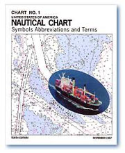 | Much News on Chart No.1 Seattle, Jun 12, 2000 — Item 1: According to a recent Notice to Mariners (No. 20, 13 May, 2000) the NOS plans to discontinue publishing the paper edition of Chart No.1—Nautical Chart Symbols and Abbreviations. Later in the Notice (we cannot find this part online, but it is in the paper edition) they explain that they do this because they now have a copy online. Hence item 2: there is now a copy of Chart No.1 online. Item 3: save that link. It is difficult to find by just searching (at least for now) and it is also the source of other valuable online nav pubs. Starpath also has had an electronic version of Chart No.1 for some time now. Ours is incorporated in our Bowditch Plus! product as well as in our Chart Trainer. Needless to say, we think ours is better! You can judge that from our online demo tours available. Ours has better graphics, the text is legible, it is indexed, searchable by graphic shape or text, has many cross links and references etc., BUT it is important to know the options... and if you only need this periodically, then you can download the free one and use it. It is, however, a bit of a task to download it. There are hot links on the table of contents entrees, but they are not marked as such. Our feeling is that the electronic publication from NIMA (as it now stands) is not a viable substitute for the printed edition. [Note added 10/30/00... they have improved the online version and it is now quite useful for on-screen viewing or printing out a hard-copy version.... still over 100 pages to coordinate, however.] They need to work on it more or, what is more likely, some private company should pick up the project and sell it as a commercial pub... as is the trend with many other government products... [10/30/00 this has indeed been done by at least two companies, but we have yet to see all the options.] Despite our reservations about this particular electronic product, the NIMA pages does have many other high-quality very useful electronic nav pubs at that link, and even promise Bowditch itself, but it is not there yet. [10/30 Now even Bowditch is there, but we have not gone through it yet. At first glance, it looks pretty good.] | ||||
| Marine Weather Services Charts Online Seattle, Jun 12, 2000 — The NWS has produced very nice electronic editions of the full set of Marine Weather Services Charts. They are in gif and pdf formats — the latter are in their native size (19x28 inches) so a trip to the Kinkos or CopyMax large printer or perhaps vertically on legal paper might do. Would be best to download and then print from Acrobat or Acrobat Reader for the most options. Or with computer access on board, just downloading for reference on the screen would be very convenient. They are about 2.3 Mb each. Also Check out the other valuable products and links at the bottom of the page there. | |||||