 |
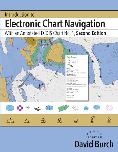
Introduction to Electronic Chart Navigation By David Burch
Electronic charting benefits all mariners, professional and recreational, large vessels and small, power and sail, racing and cruising. The unique information in this book should help mariners in any of these categories master the use of ENCs to enhance their safety and performance underway. There are many virtues of vector charts, but to take advantage of these, a new approach to “reading charts” is called for. This book explains and illustrates the process.
8.5"x 11" paperback, 158
pages, Full Color.
ISBN 9780914025573
More
and purchase... |
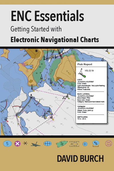 |
ENC Essentials By David Burch
By the end of 2024, electronic navigational charts (ENC) are projected to be the only official NOAA charts, and all traditional paper charts will have been discontinued. These charts are being replaced by new (reschemed) versions of electronic navigational charts (ENC) that have been in use for over 15 years in ocean shipping, but have not been used much by recreational and other commercial mariners.
6"x 9" paperback, 50
pages, Full Color.
ISBN 9780914025771
More
and purchase... |
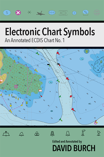 |
Electronic Chart Symbols By David Burch
A compilation of nautical chart symbols used on electronic navigational charts (ENC), edited to meet international standards and annotated to clarify nuances in the symbol usage as needed. An appendix includes a complete list of all ENC chart objects and attributes.
6"x 9" paperback, 76 pages, Full Color.
ISBN 9780914025788
More
and purchase... |
 |
Modern
Marine Weather, Third Edition By David
Burch
A new, comprehensive text
on how to take weather into account for the planning and
navigation of voyages, local or global, using the latest
technologies as well as the time-honored skills of
maritime tradition, so that your time on the water
remains as safe and efficient as possible.
8.5" x 11" paperback, 274
pages, 400 illustrations, Full Color.
ISBN 9780914025580
More
and purchase... |
 |
GPS Backup witha Mark 3 Sextant By David
Burch
No power, and batteries used up? This book and an inexpensive Mark 3 sextant lets you carry on. Alternatively, if you want to learn a basic celestial navigation position fix for any reason with minimum investment, this book shows how to do that.
It's a short book, mostly tables. You can read it in an hour or two, master the sights in less than that, and find your position the next time you see the noonday sun.
6" x 9" paperback, 98
pages.
ISBN 9780914025603
More
and purchase... |
 |
Celestial
Navigation, Second Edition By David Burch
This book covers how to
find position at sea from timed sextant sights of the
sun, moon, stars, and planets plus other routine and
special procedures of safe, efficient offshore
navigation. Includes clear explanations of how it works
and how to do it well. Plus this book covers other
crucial factors of ocean navigation besides just finding
out where you are from the stars, such as logbook
procedures, dead reckoning, error analysis, route
planning, etc. At the end of this book, you will be
ready for ocean navigation. Thousands of students have
successfully learned celestial from these materials and
gone on to cross oceans or circumnavigate the globe.
8.5" x 11", paperback, 294
pages.
ISBN 9780914025467
More
and purchase...
|
 |
Inland
and Coastal Navigation, Second Edition By
David Burch
Practical small-craft
navigation (sail or power) starting from the basics and
ending with all that is needed to navigate safely and
efficiently on inland and coastal waters in all weather
conditions. For beginners and more experienced mariners
alike. No previous knowledge is required, we start from
the basics. Many thousands of students have successfully
learned navigation from these materials and gone on to
bare boat chartering or day sailing or world cruising in
their own boats.
8.5" x 11", paperback, 230
pages.
ISBN 9780914025405
More
and purchase... |
 |
Hawaii
by Sextant By David Burch and Stephen
Miller
An extensive practice
exercise based on an actual voyage to Hawaii made solely
by celestial navigation. Includes all required table
selections and complete logbook. After
completing this passage you will be prepared to
navigate by celestial navigation on your own – if you
choose to, or need to.
8.5"x 11" paperback, 162
pages.
ISBN 9780914025184
More
and purchase... |
 |
Starpath Celestial Workforms By David Burch
Starpath work forms for sight reduction procedures in celestial navigation have been used by tens of thousands of navigators for over forty years. Designed to make the sight reduction of all celestial bodies flow in the same logical procedure that matches how data are presented in the Nautical Almanac and in the various sight reduction tables.
8.5"x 11" paperback, 86
pages.
ISBN 9780914025627
More
and purchase... |
 |
Use of the Air Almanac For Marine Navigation By David Burch
This book is intended for readers who are either already familiar with celestial navigation or are planning to take up the subject, and want to learn about optional resources. This booklet does not teach celestial navigation, nor is it a copy of the Air Almanac.
6"x 9" paperback, 62
pages.
ISBN 9780914025658
More
and purchase... |
 |
Fundamentals
of Kayak Navigation, Revised 4th Edition By David Burch
This definitive guide for
navigators contains every pertinent piece of information
needed to chart an accurate course, whether on open
water or between islands - or icebergs. Whether a rank
novice or a seasoned kayaking veteran, whether paddling
the shoreline of a friendly lake or attempting to cross
the Bering Strait, whether a kayaker or a sailor, you
will benefit from the indispensable knowledge contained
in this book.
Paperback, 7.5" x 9.25,"
300 pages, many illustrations
ISBN 9780914025528
More
and purchase...
|
 |
The
Barometer Handbook By David Burch
We now have many valuable
applications of accurate pressure, and we also have
affordable ways to get it, and we have convenient ways
to prove our instruments work properly. The main goal of
this book is to show how all this comes about, and to
give a bit more insight into this fascinating, venerable
instrument that has been with us for 150 years. Another
goal is to introduce users to the new breed of
electronic devices that are in the process of
revolutionizing how we do weather at sea.
7.5" x 9.25" paperback, 250
pages, many illustrations.
ISBN 9780914025122
More
and purchase...
|
 |
How
To Use Plastic Sextants By David Burch
—with Applications to Metal
Sextants and a Review of Sextant Piloting
Plastic sextants are
practicable at sea and preferable near land. This book
shows why. It will improve your skills with all
sextants.
7.5" x 9.25" paperback, 104
pages, many illustrations.
ISBN 9780914025245
More
and purchase... |
 |
Navigation
Workbook 1210 Tr By David Burch and Larry
Brandt
Realistic practice problems
in chart work and general navigation and the Navigation
Rules. Includes selections from tide and current tables, Light List, and Coast Pilot. An excellent companion to
our textbook on navigation. Used in navigation schools
nationwide. For use with Training Chart 1210 Tr.
8.5" x 11" paperback, 100
pages.
ISBN 9780914025443
More
and purchase... |
 |
Navigation Workbook 18465 Tr By David Burch and Larry
Brandt
Realistic practice problems
in chart work and general navigation and the Navigation
Rules. Includes selections from tide and current tables, Light List, and Coast Pilot. An
excellent companion to our textbook on navigation. Used
in navigation schools nationwide. For use with Training Chart 18465 Tr.
8.5" x 11" paperback, 104
pages.
ISBN 9780914025450
More
and purchase... |
 |
Navigation
Workbook for Practice Underway By David Burch and Larry
Brandt
This exercise book has been
used in onboard navigation training courses, power and
sail, for many years. It was originally designed for
students to carry on with practice when they were not on
watch getting direct instructor training during extended
training voyages. It can be used for day sails or long
coastal passages. Now available to the public, you can
use this workbook to guide your own study underway to
master techniques and procedures learned from classroom
or home study. Once you master the skills of these
exercises you can be confident you have a practical
working knowledge of navigation. These are skills and
procedures that every navigator should know.
8.25"
x 11", paperback, 76 pages.
ISBN 9780914025474
More
and purchase...
|
 |
Mariner's Pressure Atlas Edited By David Burch
The primary goal of this publication is to make mariners more aware of barometric pressure and how it might add to the safety and efficiency of their time on the water and to provide a specific, dependable method of storm warning in the tropics.
It is also intended to show the great value of an accurate barometer. The days of only caring about rise and fall, fast or slow, should be relegated to the history books. We now have ready access to accurate instruments and all the benefits they provide.
8.5" x 11" paperback, 62
pages.
ISBN 9780914025382
More
and purchase...
|
 |
Sailor's
Logbook
Designed for sailors by
sailors. The simple layout of these record sheets has
been tested over thousands of miles of offshore and
coastal sailing. Use the hourly numbered entries for
racing, or enter as needed for cruising.
8.5" x 11" paperback, 87
pages, matte cover.
ISBN 9780914025283
More
and purchase...
|
 |
Burch
at the Helm By
David Burch
Collected articles on
navigation and weather from the Burch at the Helm column
of Blue Water Sailing Magazine.
7" x 10" paperback, 120
pages, gloss cover.
ISBN 9780914025399
More
and purchase...
|
 |
Robert
E. Peary at the North Pole By Rear
Admiral Thomas D. Davies and members of The
Navigation Foundation
A new printing with
related correspondence of the original 1990 report to
the National Geographic Society by The Navigation
Foundation concerning the navigation and other
particulars of Robert Peary and Matthew Hensen's trip to
the North Pole in 1909. This book contains the
definitive analysis of the navigation and achievement of
the discovery.
8.25" x 11" paperback, 250
pages, vintage photograph prints and many illustrations.
ISBN 9780914025207
More
and purchase...
|
 |
Stark
Tables for Clearing the Lunar Distance By
Bruce Stark
Navigation historian Bruce
Stark has devoted many years to perfecting this modern
version of Lunar Distance tables. To our knowledge,
there are no other versions of this type of table in
print today, although tables of this type were indeed
the mainstay of navigation up till about 1900. They can
be used by navigators for practicing the old ways, or
they can indeed be used to find your longitude today
without GMT.
8.25" x 11" paperback, 250
pages.
ISBN 9780914025214
More
and purchase...
|
 |
Lunar
Almanac By Starpath
Forthcoming ...Summer 2014
8.25" x 11" paperback, 250
pages.
ISBN 9780914025245
|
 |
International
Code of Signals (Pub.102) By NIMA
The International Code of
Signals is an international system of signals and codes
for use by vessels to communicate important messages
regarding safety of navigation and related matters.
Covers visual, sound, and radio communications.
8.25" x 11" paperback, 166
pages.
ISBN 9780914025221
More
and purchase...
|
 |
Tidal
Currents of Puget Sound
This publication combines
the full Puget Sound Tidal Current Charts and Tide
Prints. Tide Prints show the flow patterns and how they
evolve throughout the current cycle. There is one print
for every 3 hours throughout the cycle. They are indexed
to the tide height in Seattle. Current Charts show the
values of the currents at each reference station. There
is one chart for every hour throughout the cycle. They
are indexed to the tidal current at Admiralty Inlet.
Comparing Tide Prints and
Current Charts shows the locations of eddies and bands
of current, and how these bands and eddies move and
interact as the current cycle evolves.
8.25" x 11" paperback, 88
pages.
ISBN 9780914025160
More
and purchase...
|
 |
Southeast Alaska Current AtlasBy Randal Washburne
An ideal resource for planning routes throughout Southeast Alaskan waters using sequential charts to predict how the current flow over large regions changes with time.
The charts in this atlas show scaled arrows marking current speeds and directions at each of the official stations at sequential hours.
Use slack times and maximum current speeds at Wrangell Narrows from the NOAA Tidal Current Tables to select the appropriate chart for specific dates and times.
8.25" x 11" paperback, 159
pages.
ISBN 9780914025542
More
and purchase...
|
 |
Secrets
of the Viking Navigators By Leif K.
Karlsen
Most navigators have heard
of Viking sunstones, but few realize they are more than
legend. Leif Karlsen has brought them to life. He shows
us how they work—now, and a thousand years ago—and what
it was that led the Viking navigators to develop this
unique tool for finding the direction to the sun, even
when the sun is obscured by clouds or fog.
6.5" x 9" paperback, 208
pages, many illustrations, and color photos.
ISBN 9780972151504
More
and purchase...
|
 |
The
Star Finder Book By David Burch
This is the third edition
of a book that has been in print since 1984. This book
turns the 2102-D Star Finder into a hand-held
planetarium, which will become your most important tool
for star ID and for planning star and planet sights in
celestial navigation. It also includes many unique
practical tables not found elsewhere, such as how to
tell the best use of the moon from its age, how to
compare brightness of stars and planets in an easy way,
which stars are reddish, and more.
7.5" x 9.25", paperback, 62
pages, 85 illus.
ISBN 9780914025634
More
and purchase...
|
 |
Portney's
Ponderables By Joe Portney
Navigation puzzles,
controversies, historical problems, and other
ponderables demystified by an expert navigator and
writer. Joe Portney is a US Naval Academy graduate and
Air Force navigator who has participated in three
historic flights over the North Pole. He is a past
President of the Institute of Navigation and recipient
of the Weems Award for continuing contributions to the
art and science of navigation. He has produced a
wonderful little book here, chock filled with
interesting tidbits, each of which can be read in a few
minutes but will stimulate your thought for many days to
come. Some are very basic, others more involved, but he
provides a clear explanation of each.
5" x 8", paperback, 170
pages, many illus.
ISBN 9780914025191
More
and purchase...
|
 |
Long
Term Almanac By Geoffrey Kolbe
Sun and Star Almanac
extended to 2050, plus concise sight reduction tables. A
complete celestial back-up to GPS, or use it as an
elegant one-book solution to celestial navigation at
sea. Includes work forms and all required auxiliary
tables, including sections on great circle routing and
compass checks.
Second Edition, 7" x 10",
paperback, 118 pages.
ISBN 9780914025108
More
and purchase...
|
 |
Radar
Workbook By David Burch and
Larry Brandt
Question and answers on
marine radar designed to accompany the Radar for
Mariners. There are multiple choice questions and
"points of ponder" questions for each of the seven
lessons listed in our online course on radar along with
the answers. Blank radar plotting sheets are included
along with a list of common radar abbreviations. This
workbook is in use by numerous schools throughout the
US. Anyone who answers all the questions in this
workbook has a sound understanding of the fundamentals
of marine radar operation.
104 pages, paperback, 8.25"
x 11".
ISBN 9780914025153
More
and purchase...
|
 |
Weather
Workbook By David Burch
This workbook is intended
to supplement the text Modern Marine Weather
with practice questions and convenient resources. All
answers are provided. The Lesson structure here matches
the chapter structure in the textbook. There are
multiple choice questions and "points of ponder"
questions for each of the ten chapters. Anyone who
answers all the questions in this workbook has a sound
understanding of practical marine weather.
70 pages, paperback, 8.5" x
11".
ISBN 9780914025092
More
and purchase...
|
 |
Notfall
Navigation von David Burch
Das lange vergriffene
Kultbuch von David Burch, einem der weltbesten
Navigatoren und Gründer der Starpath School of
Navigation, nun auf Deutsch neu erschienen. Kein
Survival-Handbuch, sondern ein umfassendes Werk über die
eigentlichen Grundlagen der Orientierung auf See, von
den polynesischen Sternenpfaden bis zum Steuern nach dem
Wind und nach Wellenbildern. Wenn die Technik teilweise
oder zur Gänze versagt sollte der verantwortungsbewusste
Skipper oder Navigator zumindest einige der hier
aufgearbeiteten Grundlagen um Kopf haben. Ein leicht
verständliches Standardwerk für alle, die sich mit dem
Hochsee-Segeln befassen. Übersetzt von Peer Reeh and
Heinz Ressl.
278 Seiten, broschiert,
190mm x 235mm.
ISBN 9780914025177
More
and purchase...
|
 |
Navigation
De Secours par David Burch
Tous les navigateurs savent
que les instruments peuvent tomber en panne. Les choses
peuvent se mouiller, se casser ou passer par-dessus
bord. Que vous soyez en sécurité sur votre bateau ou
dérivant sur un radeau de sauvetage, David Burch vous
montre comment trouver votre route quels que soient les
instruments de navigation à votre disposition. En
s’appuyant souvent sur des objets courants tels qu’un
petit bâton, un morceau de doublure ou même une paire de
lunettes de soleil, allant des techniques des anciens
Polynésiens aux traînées de condensation des avions de
ligne, David Burch vous explique comment utiliser tous
les moyens disponibles pour calculer vitesse, direction,
latitude et longitude ainsi que pratiquer tous les
aspects du pilotage et de la navigation à l’estime.
Traduit par Jean-Yves Guitton & Jean-Philippe
Planas.
298p, 190mm x 235mm.
ISBN 9780914025368
More
and purchase...
|
 |
Marine
Weather of Western Washington By Kenneth
E. Lilly, JR.
The definitive resource for
marine weather in the Pacific Northwest—the book's title
is far too restrictive for its actual content. Weather
patterns discussed apply from northern California, well
up into British Columbia, it is just that there are a
large number of actual examples from the Puget Sound and
San Juan Islands area. All well written on a thorough
yet non-technical level. This book includes real data
and analysis that will affect how you interpret and
apply marine weather information in the Northwest.
150 pages, paperback, 8.5"
x 11".
ISBN 9780916682385
More
and purchase...
|
 |
The
Nautical Almanac for 1981 By US and HM
Nautical Almanac Offices
Data in this book are no
longer valid for navigation. It is preserved in print
because many training programs (including USCG and US
Navy ) use examples from 1981 to teach celestial
navigation. USCG license exams require data from this
almanac.
314 pages, paperback, 7" x
10".
ISBN 9780914025269
More
and purchase...
|
|
________________________
Other Books By David Burch ________________________
|
 |
Emergency
Navigation
Once we have learned to
navigate by conventional methods using all available
equipment in all circumstances, the task of the prudent
navigator reduces to learning about weather and how to
navigate with only limited instruments or none at all.
This book teaches the latter subject.
268 pages, 140 illustrations, paperback,
published by McGraw Hill (2008), with a Foreword by
David Lewis, author of We, the Navigators
ISBN 9780071481847
More
and purchase...
|
 |
Radar
For Mariners
Nothing beats radar for
guiding your boat through the darkest night or the
thickest fog. Radar enables you to plot a fix from just
a single buoy or landmark, and it is the only navigation
tool that tells you not just where you are, but who else
and What else is out there with you. Today's smaller,
affordable, more powerful radars make more sense than
ever for sailors and power boaters.
250 pages, 7" x 10"
paperback, many illustrations, includes a Radar
Resources CD. Published by McGraw-Hill.
ISBN 9780071830393
More
and purchase...
|