Errata for
Introduction to Electronic Chart Navigation, Second Edition
Page 7, First paragraph, "harbor chart" should read, "coastal chart".
Page 7, Third paragraph, "(i.e., between 1:50,000 and 1:150,000)" should read, "(i.e., between 1:25,000 and 1:150,000)".
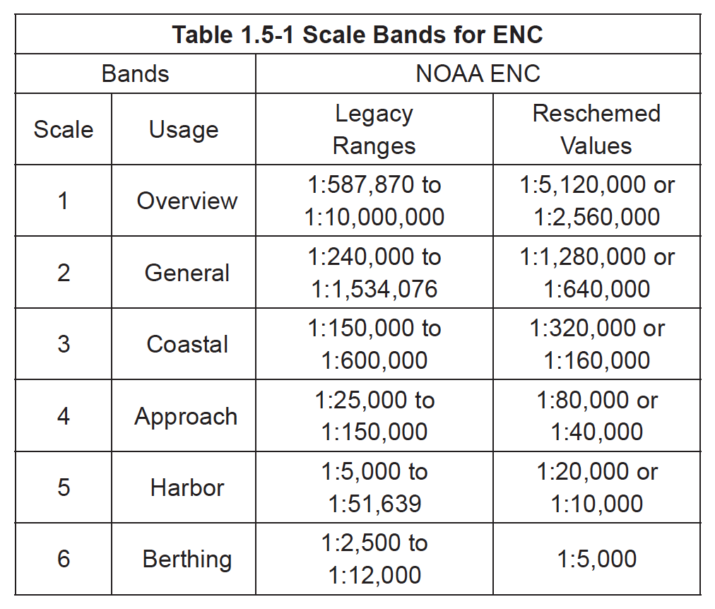
Page 7, Table 1.5-1 should be replaced with:
Page 9, Add this reminder:
Page 22: Next to last paragraph: change "user selected safety contour" to "user requested safety contour."
Page 26, Middle of the second paragraph, should read, "Thus an object with a SCAMIN...".
Page 30, Figure 2.4-2 and its caption have been updated as shown below (click to enlarge):
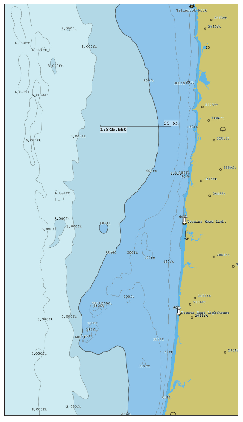 |
Figure 2.4-2. Using ENC contour assignments for coastal routing relative to the continental shelf, often found at about 100 fathoms (600 ft). In some conditions, waves along the edge of the shelf can be notably steeper than those well off to either side. It is good practice for smaller vessels to keep in mind the charted shelf location. Here we use the safety contour to mark the edge of the shelf and set the deep contour to the beginning of the ocean floor at 3000 ft. Note that the width of the shelf and indeed the drop-off to the ocean floor changes along this route. The shallow water contour was set at 60 ft. When traveling in closer to shore, a new set of contours would be selected in the normal manner related to safe depths and other concerns. |
Page 34, Section 2.5, first paragraph should read: A valuable concept in the ECDIS standard calls for the display of an isolated danger symbol whenever the sounding of a rock, wreck, or obstruction located on the safe water side of the displayed safety contour is less than the requested value of the safety contour. Note that the symbol is triggered by the requested value of the safety contour, not the displayed value shown as a bolder contour, with notable water color change. Several popular ECS programs implement this function, but not all. The symbol is conspicuous and valuable in many applications. See Figure 2.5-1. There are distinctions between when they are shown in a base display compared to a standard display mode
Page 40, Last sentence, just above Figure 2.8-2.
New wording: If you access MHW on this scale you will get, according to present NOAA convention, the larger value for all locations on the cell (see starpath.com/ENC).
Page 45, First paragraph should read: One LIGHTS challenge in some ENC is how single lights with two colors (alternating) are presented. The popular Vega VBR-25 rotating beacon, for example, can be charted as LITCHR 19 (label "Al Fl() WR") in one case and LITCHR 28 (label "Alt () WR") in another, and in yet another it might be coded as two separate lights. Until this is resolved, we need to check the Light List for alternating lights, where these are always labeled "Al WR," as they appear on paper charts.
Page 45, Table 2.11-1 should be titled Table 2.9-1.