Today, scientists are able to observe global scale ocean processes through the utilization of remote sensing, specifically satellite measurements of the ocean surface. In particular, oceanographers are able to analyze images of either seasurface temperatures (SST) or surface chlorophyll concentrations (ocean color) to infer patterns of ocean circulation.
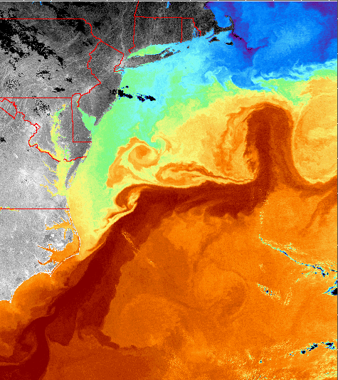
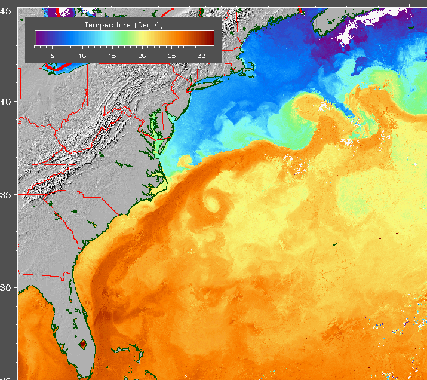
Data used to construct these images is measured from a satellite instrument known as a radiometer. The instrument measures the amount of radiation emitted from the surface of the ocean which is directly related to the surface temperature. Each temperature is then assigned a different color and an image of SST is produced.
The data used to construct the image to the right was obtained with an AVHRR (Advanced Very High Resolution Radiometer) sensor carried on a NOAA satellite. On this image, and all SST images in the Gulf Stream Tutorial, purple and blue represent the coldest temperatures (between 0-15 °C) and orange and red represents the warmest temperatures (between 22-32 °C). The Gulf Stream is easily visible on these images as the warmest water on the image.
A data point on a satellite image is known as a pixel. On the image to the right each pixel represents 1 km x 1 km of ocean. On the image below each pixel represents 4 km x 4 km. While more of the ocean can be viewed on this lower resolution image, many of the finer details are lost.
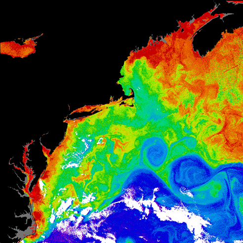
Satellite-borne radiometers also measure surface chlorophyll concentrations. In the ocean, light reflects off particulates suspended in the water, and absorption is mainly due to chlorophyll present in phytoplankton. Radiometers measure radiance at different wavelengths, and these measured radiances may then be quantitatively related to various constituents in the water column that interact with visible light, such as chlorophyll.
The image to the left was obtained by the Coastal Zone Color Scanner (CZCS). Chlorophyll concentration is color coded with minimum amounts depicted in blue (.2 mg/m3), and maximum concentration (30 mg/m3) in red. Regions of high concentrations are the nutrient rich waters of Chesapeake Bay and regions of coastal upwelling. The Gulf Stream is easily visible on the image as a region of minimum chlorophyll concentration. The northern boundary of the Gulf Stream marks the dividing line between warm, low-productivity waters to the south and the colder, more productive waters of the continental shelf.