 |
|
| Seattle, WA December , | Number 24 | ||||
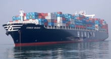 | A series of mistakes The allision of the Costco Busan with the San Francisco Bay Bridge has been evaluated in court and found to be the result of a series of cockpit errors from the pilot in charge. See San Francisco Gate article. Central to the mistakes was a misreading of chart symbols from a non standard echart system. New rules now require the pilots to carry their own PCs with known charts. Since these are so very small and work so well with Bluetooth GPS we are surprised it took such an accident to bring them into play. | ||||
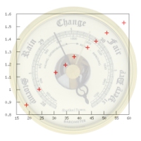 The procedures apply to aneroid and electronic barometers | New free service for barometer calibration We have made a special website to help mariners calibrate their barometers for any location... worldwide we hope, but it is new so we do not know yet how well it works overseas. We have spot checked a few cases and it seems fine. To use this go to www.starpath.com/barometers and enter your lat, lon and elevation and the service will find the nearest reference stations along with links to their pressure data sources. There is a set of Instructions available as well as a work form. | ||||
 Capt. Steve Miller | Capt Steve Miller promoted to Dean at Chapman's We are pleased to announce that Capt Steve Miller has been promoted to Dean of Professional Mariner Training Instruction at Chapman's School of Seamanship in Stuart, FL. Besides his many duties there, he also serves as one of the Starpath Online Classroom instructors. Congratulations Steve! Steve is offering a classroom course in celestial navigation at Chapman's in Stuart, FL beginning on Feb 11, 2008. Contact Chapman's directly to inquire about this course (800-225-2841). The Chapman's course uses the Starpath texts on celestial navigation. It is a fine course presentation with hands-on sextant sight practice. Highly recommended. They also have dormitory accommodations for those interested. | ||||
 www.ion.org | Navigation in K12 Eduction If you are a teacher or friends with one who might like to include navigation in their curricula as a way to introduce math, history, geography, astronomy, meteorology, oceanography, politics, etc... the list is endless, then a good place to start is the Institute of Navigation's education site. They have many lesson plans set out. Also do not hesitate to contact us at Starpath. We help many high schools and grade schools around the country with materials and products for using navigation as a way to teach science and math, not to mention history and the humanities. We also offer a free copy of our high resolution scan of the 1851 Bowditch to any library that writes and asks for it. A form is provided. | ||||
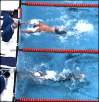 Two touches 0.01 seconds apart. | Phelps wins race by 0.01 seconds. How much is that? In the olympics Michael Phelps won his 7th gold medal in a 100 meter butterfly race. Unlike his other events, however, this one was very close. The electronic timing showed him touching with a final time of 50.58 seconds, but the swimmer beside him touched with a total time of 50.59 seconds. Thus he won by just one hundredth of a second... or as one newspaper put it, just 10 milliseconds. There were immediate protests from the second place finisher and the international TV broadcasters started talking about the difference being only a "fingernail thickness" difference in the two touching times. But was it really that close? We need some basic navigation calculation to see what is going on. He finished the 100m in 50.58 seconds, so his average speed was (100/50.58) m/s. So it is very easy to see how far he moved in 0.01 seconds. Namely 0.01 x (100/50.58) = 0.0198 meters = 1.98 cm, which is about one inch (2.54cm). Thus he won by just under one inch. That is not a "fingernail" thickness. It is obvious small, but still quite measurable with the technology they use. There does not seem to be any reason to think this is not fair, or should be compromised—some proposed they should share the first place. Even counting the fact that the sensor had to be depressed or contacted in some manner that might complicate the analysis, ie it might require some degree of contact or pressure, which could mean that one person got there first but in the process of their gentle touch, the next comes in with a blast and sets it off. My guess is, these swimmers know how the sensors respond and it is part of their training to do their best to hit it right. Just an example of where a simple speed time distance computation helps us analyze things off the waterway. | ||||
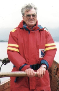 Leif Karlsen at the helm of a Viking sailing ship | Leif Karlsen Rememberance We are sad to report the loss of our friend and associate Leif Karlsen, author of Secrets of the Viking Navigators. Please see Rembembering Leif. | ||||
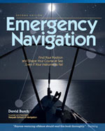 Cover of 2008 edition. | Emergency Navigation, second edtion, Now Available. This book took 6 years to write and was first published in 1986. This edition lasted till 2006, then the publishers forced us, screaming and kicking, into a new edition by letting it go out of print. Between 2006 and 2008 the used book price climbed to $300 with a record sale at $565, according to online book store reports. Now finally we have completed the second edition and it is now available. See Emergency Navigation, second edition. This page has a link that outlines the updates in the new edition. We will open up our new online course on Emergency Navigation in the near future, which will go through the book step by step with practical examples and exercises on each technique. | ||||
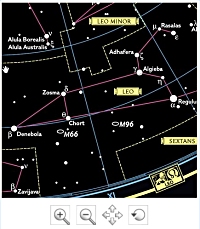 Star Map viewer on National Geographic web site | A great star map we no longer sell! We recommend a great star map in our accessories section called the Map of the Heavens, but we stopped selling it sometime ago, and direct you to the sales at the National Geographic Society. The reason we stopped selling it was it was so hard to package in custom tubes to add to other orders. To cover our expenses we had to charge more than you could get it by going there directly... although there was a period of some years where we sold it but they did not. | ||||
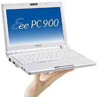 Sample of a mini PC | NYT features mini computers It is our feeling that the future of electronic navigation for small craft is in the field of very small, full funtion PCs—sometimes called ultra mobile, sometimes mini PCs. The NYT has just come out with an article on them (see NYT on mini PC), which is a step in that direction. We also think this technology will be the future of ebooks as well, for which our own elibra ebook program is so well suited. See links in Literary Sailor. This is the same ebook system we use for our online study materials. | ||||
 | Free Navigation Calculators and custom link to NavPubs A reminder that in our downloads page we offer a free set of calculators that are very convenient for many (35) different functions in navigation and weather. These were originally developed by NIMA but are rather awkward to use as is, so we have simply repackaged them to download and use as a regular software program. | ||||
 | National Association of State Boating Law Adminstrators Announces Adoption of Radar For Mariners Textbook From May-June Issue of the NASBLA Small Craft Advisory The American Sailing Association has added a Radar Endorsement program for their Affiliate Schools. The purpose of the program is to standardize the teaching of radar for the recreational boater. ASA Affiliate Schools across the country are teaching this Radar Course to those students that have already taken the Coastal Navigation 105 course. For a list of schools that are participating, visit www.asa.com. The textbook Radar for Mariners and Radar Workbook both by David Burch will be used for the program. The following standards will be taught: • How radar works • Radar Operation • Interpreting the screen • Piloting • Position navigation • Collision avoidance • Radar and the Navigation Rules American Sailing Association hopes that this national program will aid in the proper education of recreational mariners using radar and increase the safety and confidence of these participants. | ||||