Support for...
 Click pic for book details |
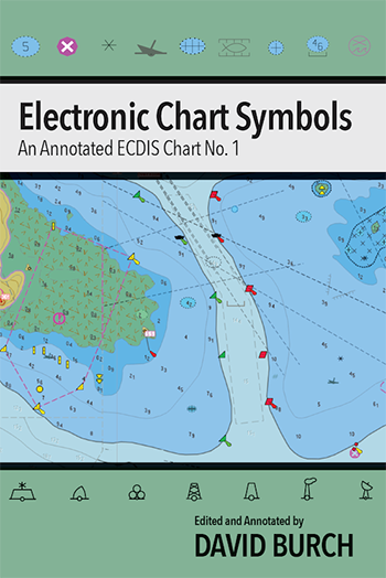
 Click pic for book details |
 Click pic for book details. |
New online course devoted to reading and navigation with ENC Electronic Chart Navigation |
||
Internet links referenced in the books that we keep up to date here—in no logical order. If you find a link that does not work, please send notice to helpdesk@starpath.com. 2. IHO ENC and ECDIS Standards in Force 3. IHO Catalog of International ENC... see also starpath.com/getcharts 13. NOAA's Precision Marine Navigation portal 14. Air gap system for live air draft 15. Value of NOAA PORTS services 16. Accuracy of NOAA chart data 17. Starpath Pocket Navigation Rules Handbook 18. World Magnetic Model and geomag software 20. U.S. Coast Pilot 21. Bowditch, American Practical Navigator, NGA Pub. 9 24. High Resolution Rapid Refresh (HRRR) model and others described at LuckGrib.com 25. Grib files for meteorology and oceanography (Saildocs) 26. Download NOAA Charts and access Online ENC Viewer... see also starpath.com/getcharts 28. Free Inland ENCs 29. NOAA Custom Chart descriptions and app links 30. Printing NOAA Custom Charts (NCC) 31. NOAA Rescheming Program with links to program status 32. Implementing the National Charting Plan 33. IHO S-100 Introduction Video (Dec, 2015) 34. IHO S-100 Overview Video (Sep, 2021) 35. IMO Performance Standards for Electronic Chart Display and Information Systems (ECDIS) 36. Complete list of objects in each display mode. 37. USCG proposed ruling requiring the use of ENC for non-ECDIS vessels 38. MHW on ENC
|
||
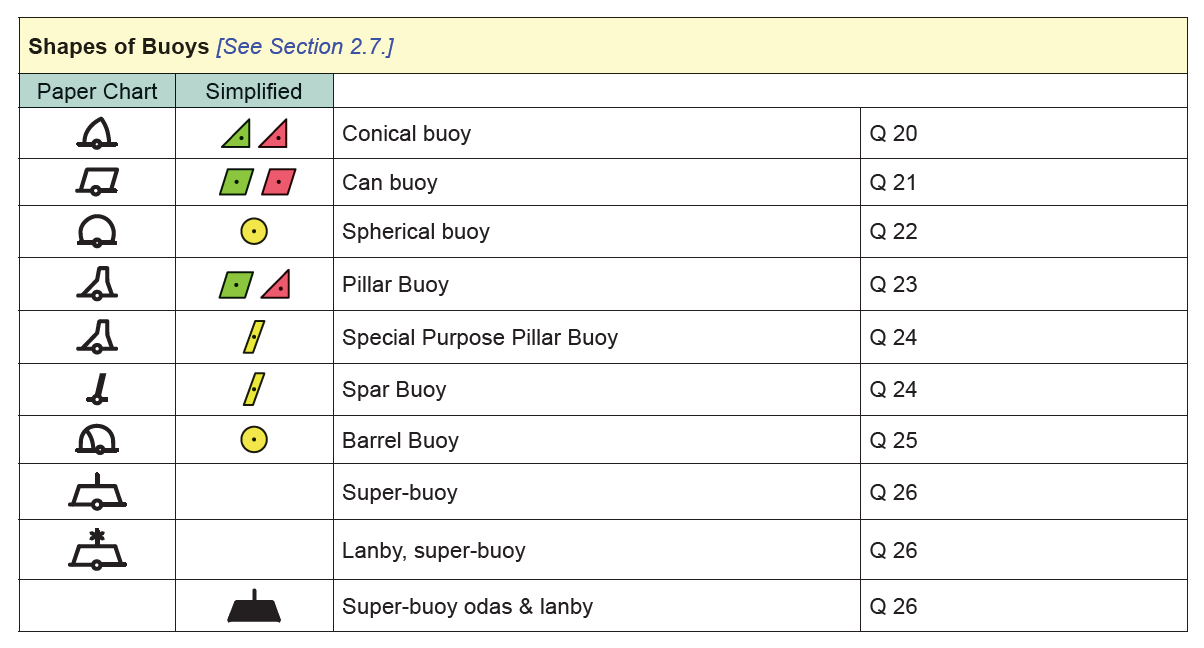
Updates / News NOAA has begun updating ENC daily (10:00 UTC, except Sundays), as opposed to weekly on Thursdays as stated in the books. Intro to ECN page 9, Essentials page 10. In Essentials, page 8 and 9 on chart names, we chose examples from San Pedro Bay, CA as these were new, reschemed charts, but NOAA just now (Oct, 2023) decided the bathymetry was not accurate enough for these 1:5,000 charts so they have removed that set of 11 berthing charts, at least temporarily. We will wait awhile before changing the example to see if they get reinstated. In the meantime to see other large scale reschemed charts, look at the NE US in the NOAA ENC catalog. Some updates to Buoy Symbols (Page 114 in Intro to ECN, page 58 in Electronic Chart Symbols.)
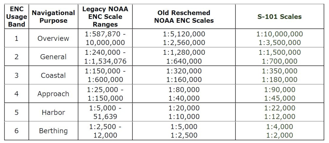
Replace Rescheming Scales Tables in all books.
|
||