 |
 |
|||||
AIS is fundamental to safe navigation
|
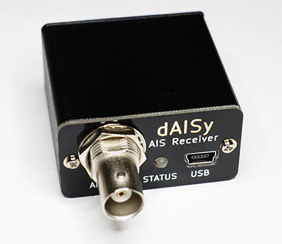
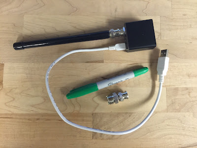
dAISy Portable AIS Receiver
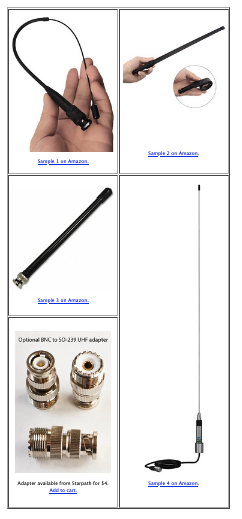
With dAISy all you need to track nearby vessels is a VHF antenna and any navigation software, including free options OpenCPN and qtVlm $ ...item# AIS-1
|
 |
|||
|
AIS is crucial for collision Avoidance
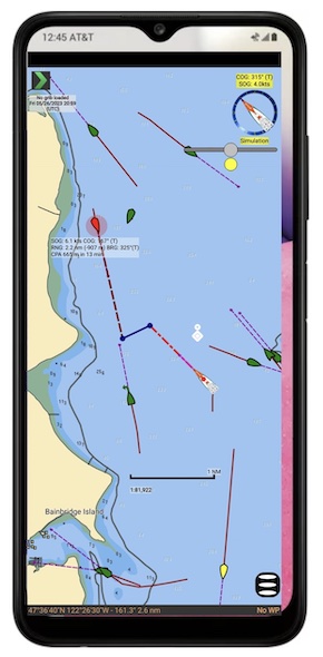
Free computer nav apps such as OpenCPN or qtVlm, and other commercial apps provide valuable vessel ID and closest point of approach (CPA) data using dAISy signals. Sample below.
Far superior to secondhand sources
For smaller vessels For racing and chartering Ideal for racing and charter skippers who travel to different boats. With a small stubby antenna you are prepared to add AIS safety to any vessel you sail on. All fits unnoticeably in your laptop case. Take part in global AIS reporting Living near the coast or navigable rivers, the dAISy is well suited for reporting local ship traffic to services like MarineTraffic, FleetMon, AISHub or Pocket Mariner who then distribute the data on websites giving you credit for your reporting. dAISy features
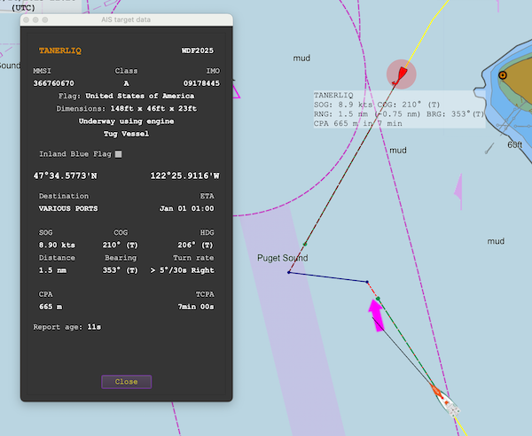 CPA display of AIS data in qtVlm. The green dots are where each vessel will be in 6 min. The target is marked red because it has a CPA less than the 0.5 nmi (925m) limit we set. This will occur in 7 minutes, at which time the target will pass on our port bow at a distance of 655m. We see that our vessel is slipping north in a current (COG predictor line to the right of the heading line). At the moment of this picture, the target is 1.5 nmi off in direction 353, heading 210 at 8.9 kts. This target is the 148-ft oceangoing emergency response tug Tanerliq ("tun-ul-lik") — a notable vessel in these waters.
Review from a regular user
Note that third party niche hardware such as the dAISy do not typically run on iOS devices due to excessive Apple license fees, but once you have this running on an Android device using qtVlm, you can then wifi all of the nav data from the device including the live AIS data to nearby iPhones and iPads running any navigation programs of your choice... or to any computers on the boat. Multiple connections work fine. Thus an inexpensive Android phone such as the Galaxy A03s (has GPS and barometer) you have a back up to position, COG, SOG, baro, and AIS. Add our Marine Barograph app to the device and it then also serves as a nav data recorder storing time, position, COG, SOG, and barometer in long-term, easy-to-access data logs. |
||||