|
Author
|
Topic: Nav Workbook 1210tr ex 6-10
|
Lance
|
 posted April 24, 2020 10:01 PM


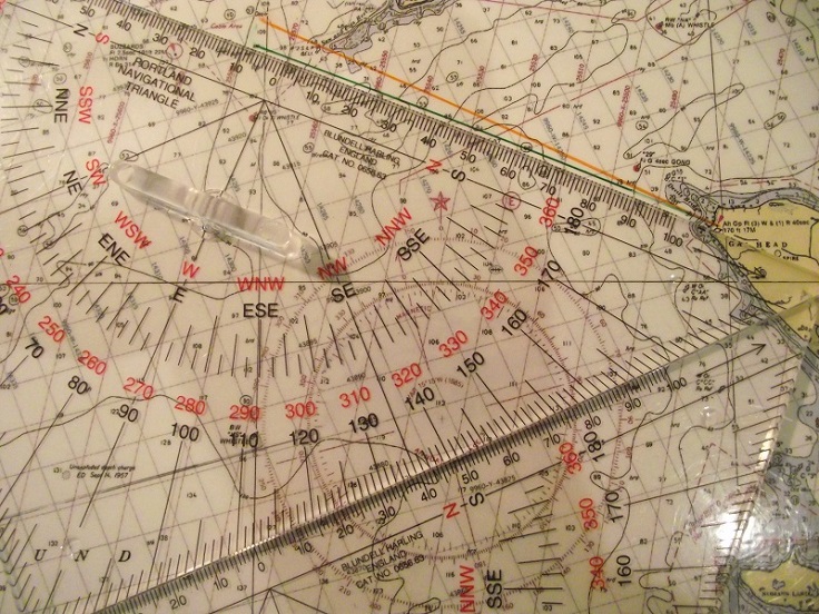
The answer given for problem 6-10 is "Not over 130°M". If I draw a line from the Gay Head light on true bearing 130°/310°M or 115°/295°T, it seems to run almost over the marked position of the Sow and Piglets light, close to the reef (orange line on the attached image).
My understanding of the problem is that we wish to pass southwest of the marked location of this light, coming no closer than 0.25 nm. Laying my navigational triangle along 112°/292°T or 127°/307°M from the Gay Head light, I get a line that passes on the southwestern side of the Sow and Piglet's buoy position, and I think it's about .25 nm away at the closest approach. I am new to the navigational triangles, though, (just arrived n the post a few days ago) so I could very easily be wrong. Or have I got the location of the Gay Head light wrong, perhaps?
I thought the answer would be 'Not over 127°M'.

From: Hobart, Australia
|
|
Lance
|
posted April 24, 2020 10:05 PM
Let me try to attach that file again...
From: Hobart, Australia
|
|
|